The horrible Beirut Port explosion, in addition to causing the catastrophic death of almost 200 innocent people as well as critically injuring thousands, has damaged if not destroyed hundreds of buildings and thousands of flats. Although the call for rebuilding Beirut was immediate and attracted global support, a formal assessment of the damage incurred is needed to establish the right rebuilding strategy.
The damage assessment requires capturing and documenting the damage caused at each neighborhood, building, floor, and flat. In addition to the damage assessment information that needs to be captured at all those locations, supportive documents, pictures, and drawings among others need to be collected and attached to all those assessments.
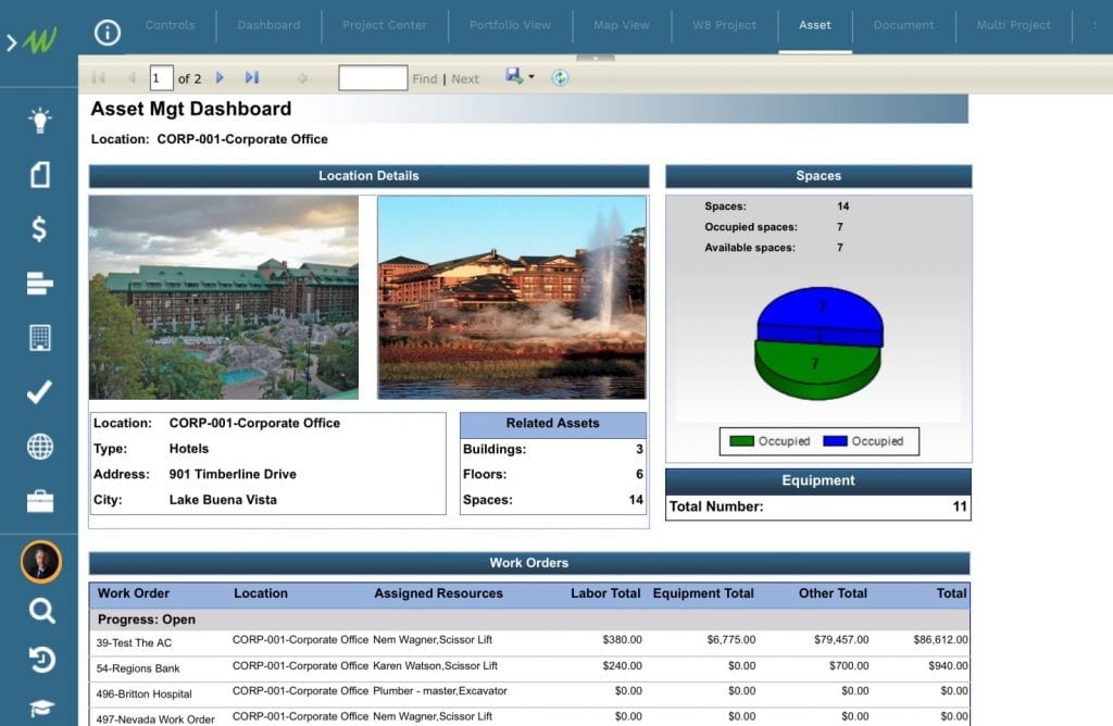
Although Project Management information systems (PMIS) like PMWeb are mainly used to manage the rebuilding programs and associated projects to provide the very much-needed transparency, accountability, and governance that all donating agencies are insisting on having before they commence funding the rebuilding effort, PMWeb also comes ready with an asset management module that can be immediately deployed, as is out-of-the-box to document the damage occurred to all locations, buildings, floors, and spaces.
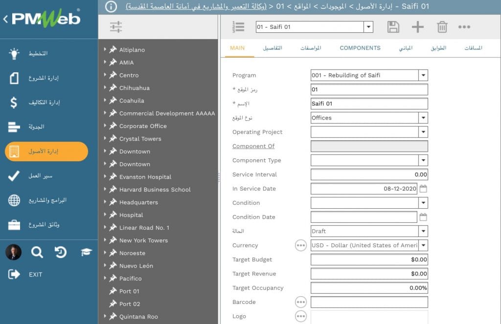
To start with, the asset location breakdown structure needs to be created. For example, the first level of the breakdown structure will be the different blocks, zones, sub-zones, or neighborhoods that were affected by the Beirut explosion. This could be as an example, Saifi Neighborhood 01, Saifi Neighborhood 02, Saifi Neighborhood 03, Port Neighborhood 01, Port Neighborhood 02, and so on. The second level will be the buildings within each neighborhood or block such as buildings 01, 02, 03, etc. The third level will be the floors within each building. For example, this could be the first-floor level, second-floor level, third-floor level, and so on. The last level will be the space level and those would be the flats, shops, restaurants, and the common areas within each floor.
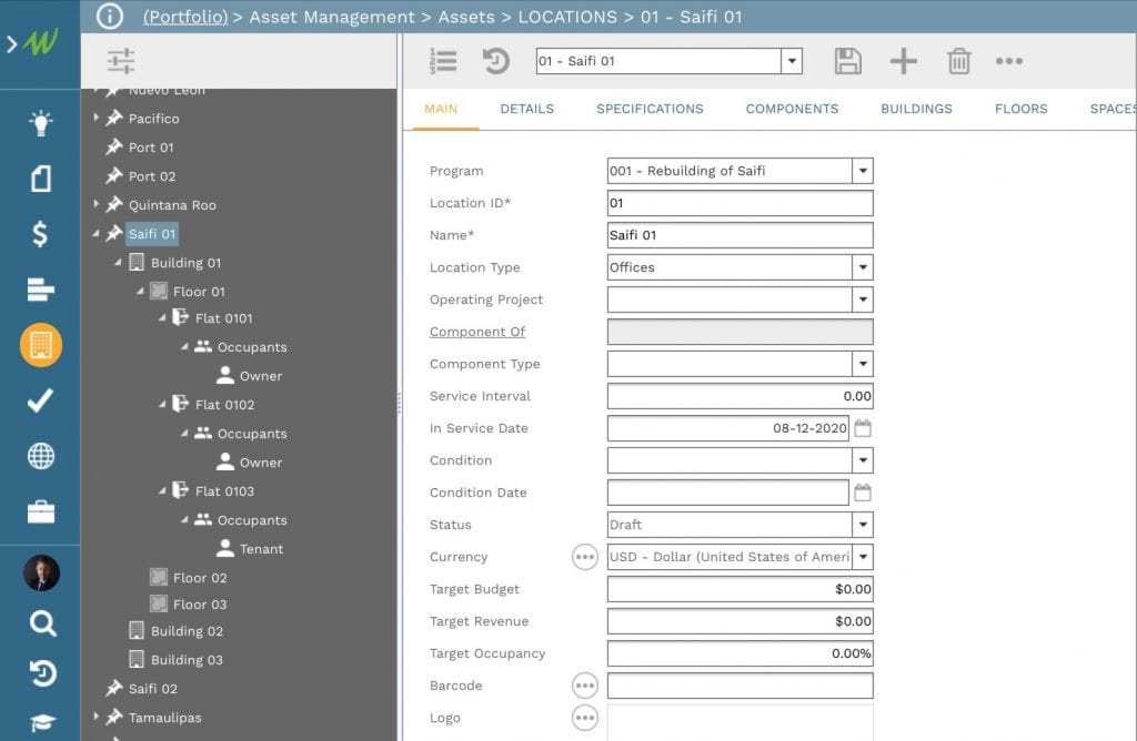
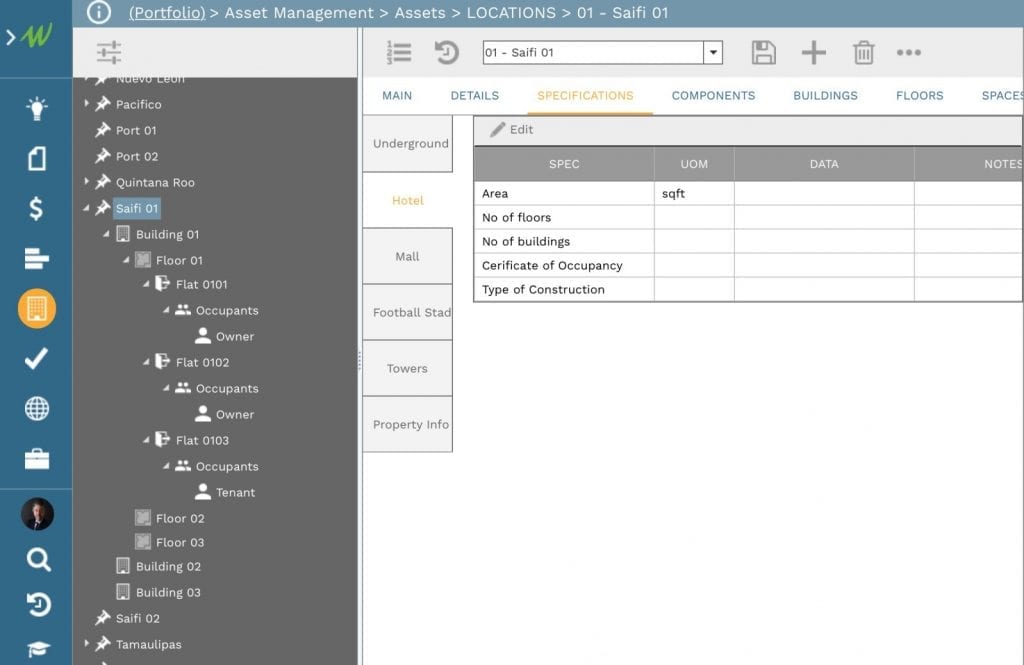
For each defined location breakdown structure level, PMWeb allows defining an unlimited number of fields to detail each level and provide a better description of what it entails or what it includes. Some of those fields are available by default while others can be created using the PMWeb specification module where some can be displayed on the main header while others could be displayed on the specification tab. Those user-defined fields could be text, number, currency, date, Boolean as well as the option to have a value selected from a pre-defined list of values.
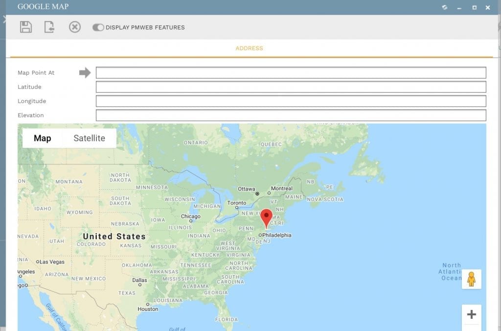
To improve the identification of locations, buildings as well and levels, PMWeb allows adding the GIS attributes to those levels which includes the longitude, latitude, and elevation values. This allows visualizing those locations and buildings on a map as one of the reports that are used to report on the different damage assessments carried out by the project team. In addition, this allows associating the assessment information captured in PMWeb with spatial information applications like ESRI.
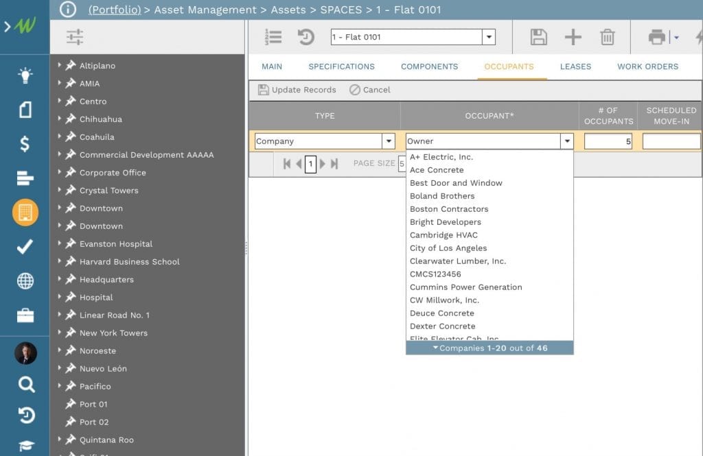
In addition, PMWeb allows adding the details of occupants at each identified space using the PMWeb companies module. There is the option of grouping occupants as tenants and owners or detailing them to include all families as well as members of each family if this level of detail is needed. This enables tagging those occupants to the relevant space that they were living in. PMWeb also allows defining the planned actual move-in dates for those occupants to their relevant spaces.
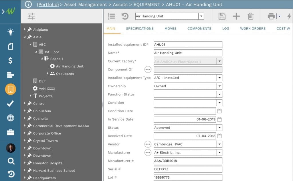
If required PMWeb also allows adding and assigning all equipment assets to the building, floor, or space that they were located at when the explosion has happened. Those could include for example elevators, HVAC equipment and units, cars, and vans among many others. There is no limit to the number of equipment assets that can be captured in PMWeb as well as the details of those captured assets.
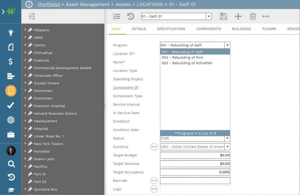
Since the different identified locations and buildings would become part of the anticipated Beirut Rebuilding initiative which includes specific programs for each neighborhood, the PMWeb program module will be used to create those programs and associate them with their relevant locations. When the Beirut rebuilding program effort commences, projects within each location will be created so they can be managed and delivered.
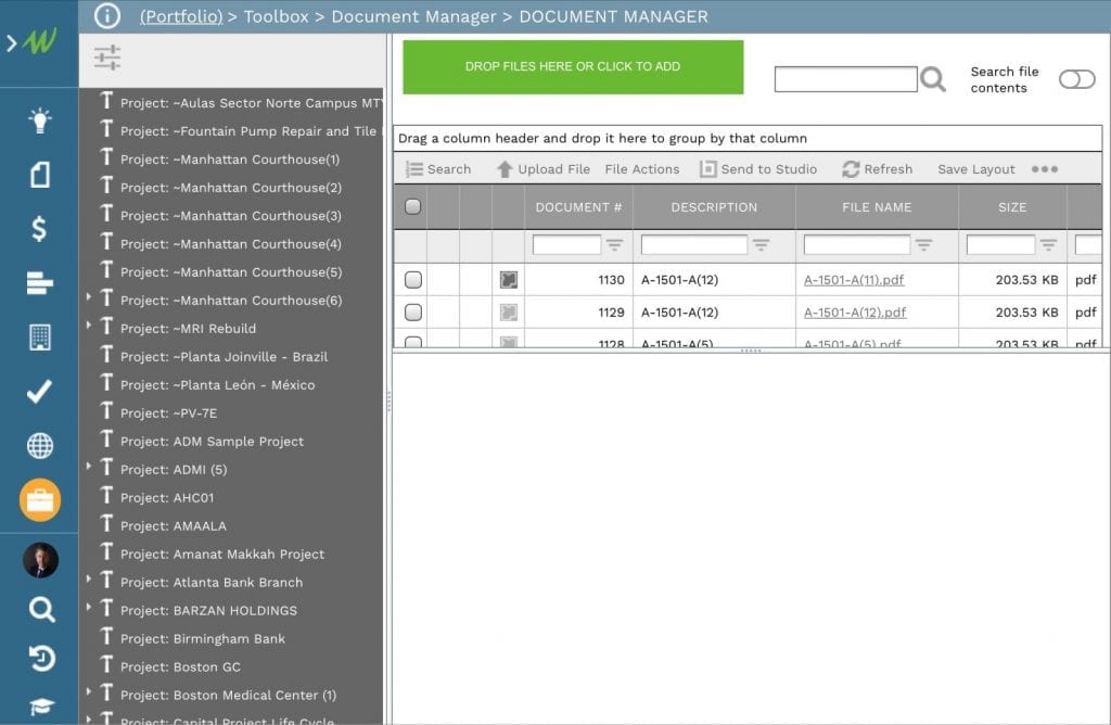
PMWeb document management repository is used to create the folders and subfolders that match the location’s breakdown structure levels. The first folder level is the program name and then under each program, it is followed by the location, building, level, and space folders. Under each folder, the related assessment documents and reports, pictures, drawings, and other documents are uploaded and stored so they can be attached to their relevant PMWeb record.
Since PMWeb is a 100% web-enabled platform, with zero footprints with a responsive user interface, PMWeb can be accessed anywhere, anytime, using any smart device and any browser with the option to change the user interface language to any desired language, say Arabic instead of English. Of course, access rights and other user permissions need to be created in accordance with the client’s own data security requirements.
The data captured in PMWeb becomes available to be reported on in any desired form and format to fulfill the reporting requirements of the organization. This real-time, single-version-of-the-truth reporting can be shared with entities that are authorized by the organization to monitor and evaluate the damage assessment effort.
